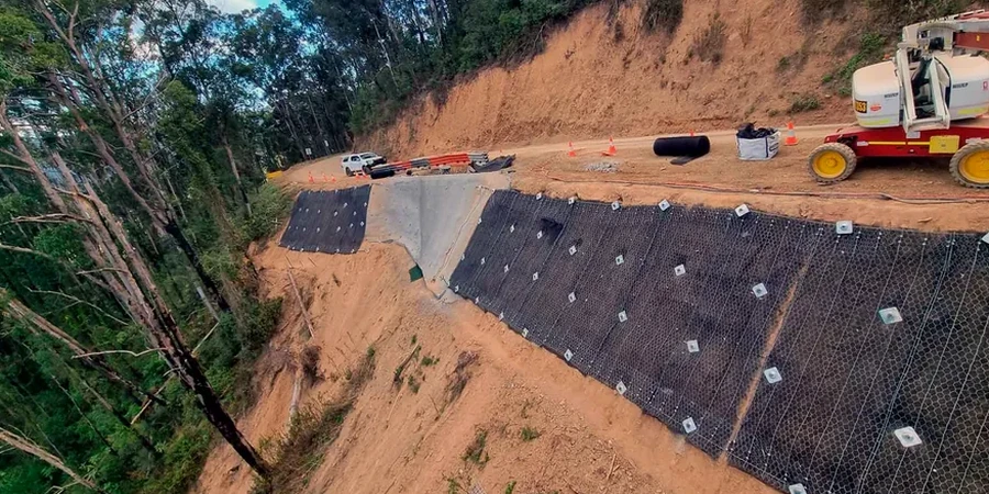
Columbus developed along the Scioto River, where the transition from the low-lying floodplain to the upland till plains created a landscape of natural and engineered slopes. The glacial history left behind a complex stratigraphy of Wisconsinan-age tills, outwash sands, and lacustrine clays that behave very differently under load. As the city expanded outward from downtown into areas like Dublin, Westerville, and the Olentangy River corridor, road cuts and residential developments increasingly intersect these deposits. The lab team regularly sees projects where a test pit investigation reveals slickensided clay seams at depth that completely change the design assumptions. A reliable slope stability analysis in Central Ohio must account for the stiff, overconsolidated nature of the upper till and the potential for softer, wetter layers beneath.
A factor of safety of 1.5 under the phreatic surface condition is the minimum we verify for permanent cut slopes in Columbus's overconsolidated glacial tills.