Geotechnical investigation in Columbus, Ohio, encompasses the systematic evaluation of subsurface soil, rock, and groundwater conditions to inform safe and economical design of foundations, earthworks, and infrastructure. This category covers a range of field and laboratory methods—from exploratory borings and sampling to in-situ testing—that collectively reduce uncertainty in ground behavior. In central Ohio, where glacial deposits and weathered shale dominate the near-surface profile, a thorough investigation is not just a regulatory formality but a practical necessity to avoid differential settlement, slope instability, or groundwater-related failures.
Columbus sits near the boundary of two physiographic provinces: the till-covered plains of the Central Lowland to the west and the unglaciated Appalachian Plateau to the east. Much of the metro area is underlain by a complex sequence of Wisconsinan-age glacial tills, outwash sands and gravels, and laminated lacustrine silts and clays deposited during multiple ice advances. These units can vary dramatically in thickness, density, and drainage character over short distances. Beneath the glacial drift, the bedrock is predominantly Devonian-age Ohio Shale and, in some corridors, limestone of the Delaware Formation—each presenting unique challenges for excavation, bearing capacity, and lateral support. Understanding this stratigraphy through targeted investigation is critical for projects ranging from high-rise foundations in the Short North to bridge abutments along the Scioto River.
Professional practice in Ohio is governed by the Ohio Revised Code and the Ohio Administrative Code, which require that geotechnical investigations be performed under the responsible charge of a registered Professional Engineer. The Ohio Department of Transportation (ODOT) publishes its own Specifications for Geotechnical Explorations (Supplement 1012) and the Geotechnical Design Manual, which set minimum standards for boring spacing, sampling frequency, and in-situ testing—commonly including CPT (Cone Penetration Test) for stratigraphic profiling and liquefaction assessment. Additionally, the City of Columbus Building Code references the International Building Code (IBC) Chapter 18, mandating that foundations be designed on the basis of adequate soil data. These norms ensure that investigation scopes are not left to guesswork, protecting both public safety and project investment.
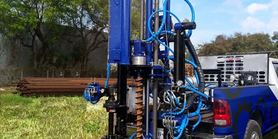
The types of projects that demand a comprehensive geotechnical investigation in Columbus are diverse. Commercial developments in the Arena District, industrial warehouses near Rickenbacker, municipal water-retention basins, roadway widenings along I-270, and residential subdivisions on the city's expanding northeast fringe all rely on site-specific data to manage risks like expansive clay heave, karst-related subsidence in limestone areas, or liquefaction in loose alluvial sands. Even smaller ventures—such as cell tower foundations or retaining wall replacements along cut slopes—benefit from a scaled investigation that identifies critical layers and groundwater elevations. Field methods like CPT (Cone Penetration Test) are often valued for their speed and continuous profiling capability, particularly in soft clays and silts where traditional split-spoon sampling may disturb sensitive fabric.
A geotechnical investigation identifies the subsurface soil, rock, and groundwater conditions at a site to guide foundation design, earthwork, and drainage planning. In Columbus, where glacial tills and shale bedrock create variable ground conditions, the investigation helps prevent structural settlement, slope failures, and water problems, ensuring compliance with Ohio building codes and ODOT standards.
The City of Columbus, through its adoption of the International Building Code (IBC), requires a geotechnical investigation when foundation design relies on soil properties that have not been adequately documented. Projects involving deep foundations, fills, or sites with known problematic soils—such as expansive clays or loose sands—typically trigger the requirement. The report must be sealed by an Ohio Professional Engineer.
Boring depths depend on the project scope, but common practice in Columbus ranges from 20 to 60 feet for standard structures, extending deeper for high-rise buildings or bridge foundations. Borings generally penetrate through the glacial drift into competent bedrock—often Ohio Shale or limestone—to evaluate both overburden and bearing stratum. ODOT guidelines offer minimum depth criteria for transportation projects.
Standard borings retrieve disturbed and undisturbed soil samples for visual classification and laboratory testing, while a Cone Penetration Test (CPT) pushes an instrumented cone into the ground to continuously measure tip resistance, sleeve friction, and pore pressure. CPT provides high-resolution stratigraphic profiles without sampling and is especially useful in Columbus's soft clays and silts for detecting thin layers that affect drainage or stability.
We serve projects across Columbus Ohio and surrounding areas.